
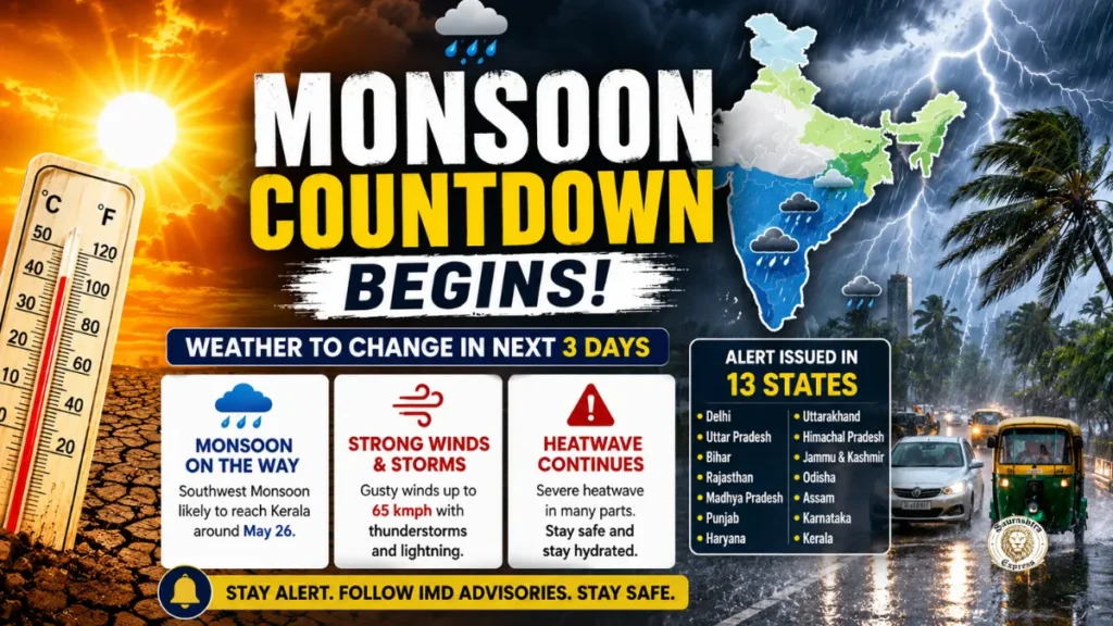
After weeks of relentless heat across large parts of India, signs of a weather shift are finally beginning to emerge. The India Meteorological Department (IMD) has indicated that the southwest Monsoon is advancing steadily and could begin changing weather conditions in several regions over the next three to four days.
While the approaching Monsoon is expected to bring relief from severe temperatures, the transition is also likely to trigger intense pre-monsoon activity. Authorities have issued alerts in multiple states for thunderstorms, strong winds, lightning, and heavy rainfall. In some areas, wind speeds may reach up to 65 kilometres per hour.
At present, northern and central India continue to struggle under dangerous heatwave conditions. Cities across Delhi, Uttar Pradesh, Rajasthan, Bihar, Punjab, Haryana, and Madhya Pradesh have recorded temperatures ranging between 45 and 47 degrees Celsius. Roads remain deserted during the afternoon, and even nighttime temperatures are offering little comfort.
Meteorologists say the coming days will represent a crucial transition period as heatwave conditions slowly weaken and Monsoon systems become more active across the country.
Monsoon Advances Towards Kerala Coast
According to the IMD, the southwest Monsoon has already covered parts of the Andaman and Nicobar Islands and several areas of the Bay of Bengal. Weather experts expect the Monsoon to reach the Kerala coast around May 26, marking the formal beginning of the rainy season over mainland India.
Once the Monsoon enters Kerala, rainfall activity is likely to intensify across southern India and gradually spread toward the northeast and eastern regions. Increased moisture over the Arabian Sea and Bay of Bengal is expected to play a major role in this shift.
At the same time, a western disturbance is becoming active over northern India. This weather system may bring dust storms, cloudy skies, isolated rain showers, and gusty winds to Delhi, Punjab, Haryana, Rajasthan, and western Uttar Pradesh.
Private forecasting agencies and IMD officials both suggest that the final week of May could bring a noticeable drop in temperatures in several heatwave-affected regions.
Severe Heatwave Still Gripping North India
Despite the expected weather change, officials have warned that the next 48 hours could remain extremely difficult in many states.
The IMD has issued red and orange alerts for intense heatwave conditions in several regions. Residents have been advised to avoid stepping outdoors during peak afternoon hours, stay hydrated, and take precautions against heat-related illnesses.
Health experts warn that prolonged exposure to high temperatures can increase the risk of dehydration, heat exhaustion, and heatstroke, particularly among elderly people, children, outdoor workers, and those with existing medical conditions.
Delhi-NCR May See Weekend Relief
Delhi and the surrounding National Capital Region continue to experience severe summer conditions. Day temperatures in the capital have remained close to 45 degrees Celsius, while nighttime temperatures have hovered around 31 degrees, leaving residents with little respite.
The IMD has issued a red alert for the region for the next few days. However, weather conditions may begin to change from the night of May 23 onward.
Due to the influence of the western disturbance, Delhi, Noida, Gurugram, and Ghaziabad could witness dust storms, cloud cover, and light rain. Meteorologists believe temperatures may fall by two to three degrees if rainfall activity develops.
Air quality levels in parts of Delhi-NCR have also deteriorated due to dry winds and dust accumulation.
Uttar Pradesh Facing Double Impact of Heat and Hot Winds
Uttar Pradesh remains among the worst-affected states in terms of heatwave intensity. Districts such as Banda, Prayagraj, Varanasi, and Jaunpur have reported temperatures nearing 47 degrees Celsius.
The IMD has issued red alerts in several districts and yellow alerts in many others as scorching winds continue to affect daily life.
However, eastern parts of the state may witness thunderstorms and isolated rainfall within the next two days. Officials believe broader relief could arrive toward the end of May as Monsoon systems move closer to northern India.
Farmers are also closely monitoring weather developments, as pre-monsoon showers may help prepare fields for upcoming agricultural activity.
Bihar Braces for Thunderstorms and Lightning
Bihar is currently witnessing a mix of intense daytime heat and evening storm activity. Several districts, including Patna, Bhagalpur, Purnia, and Muzaffarpur, are expected to experience strong winds accompanied by rain and thunderstorms.
The IMD has warned of lightning strikes and wind speeds between 50 and 70 kilometres per hour in some locations.
Southern Bihar may continue to remain under heatwave influence even as storm activity increases in other parts of the state. Local authorities have advised residents to avoid open spaces during thunderstorms and remain alert during lightning activity.
Rajasthan Likely to Witness Dust Storms
Rajasthan continues to battle extreme temperatures, especially in western districts. Sri Ganganagar has recorded temperatures above 46 degrees Celsius, while several other areas remain under severe heatwave conditions.
Meteorologists say western disturbances could trigger dust storms in Jaipur, Bikaner, and nearby regions. Light rain is also possible in isolated pockets.
Although temporary relief may occur due to changing weather patterns, forecasters expect temperatures to rise again after May 24 in parts of the state.
Madhya Pradesh on High Alert for Heatwave
More than 30 districts across Madhya Pradesh remain under heatwave alerts. Cities including Bhopal, Gwalior, Sagar, Jabalpur, and Shahdol are experiencing temperatures above 45 degrees Celsius.
Officials say the next two days could remain particularly challenging. Some districts may witness cloud formation and isolated rain activity, but widespread cooling is not expected immediately.
Health departments have urged people to avoid unnecessary travel during afternoon hours and remain cautious about dehydration.
Punjab and Haryana Could See Weather Shift
Parts of Punjab have already witnessed isolated rainfall and thunderstorms, bringing temporary relief from the heat. Areas such as Hoshiarpur, Phagwara, Jalandhar, and Pathankot reported gusty winds and lightning activity.
The IMD expects unstable weather conditions to continue over the next couple of days.
In neighbouring Haryana, districts including Hisar, Bhiwani, Rohtak, and Jhajjar may experience dust storms and light rain as the western disturbance strengthens. Temperatures could dip slightly if cloud cover increases.
Weather Activity Intensifies in Hill States
The Himalayan region is also expected to witness unstable weather conditions.
In Uttarakhand, districts such as Dehradun, Nainital, and Uttarkashi may receive rainfall accompanied by thunderstorms and hail. Authorities have advised tourists and residents in hilly regions to remain cautious.
Himachal Pradesh is also likely to experience rain and gusty winds in Shimla, Kullu, and Mandi. Higher-altitude areas near Rohtang Pass and Shinkula Pass have continued to receive snowfall, leading to a noticeable drop in temperatures.
Jammu and Kashmir may witness rainfall, hailstorms, and strong winds reaching up to 70 kilometres per hour in some areas, according to weather officials.
Odisha Faces Both Heatwave and Rain Alerts
Odisha is experiencing a combination of rising temperatures and increasing thunderstorm activity. The regional weather centre in Bhubaneswar has issued alerts for several districts, warning of both heatwave conditions and possible lightning strikes.
Districts including Bhadrak, Jajpur, Kendrapara, Balasore, Cuttack, Angul, and Puri could experience thunderstorms, gusty winds, and light rainfall over the coming days.
The IMD has advised residents to remain alert during changing weather conditions, especially in coastal and interior districts vulnerable to lightning.
Northeast India Already Seeing Heavy Rainfall
Pre-monsoon activity has become significantly stronger across northeastern states including Assam, Meghalaya, Arunachal Pradesh, and Nagaland.
Several areas have reported continuous rainfall, raising concerns about flooding and landslides. Weather experts believe the Monsoon may become fully active in the region within the next few days.
Disaster management teams in some states are monitoring vulnerable zones as rainfall intensity increases.
Also Read: Digital census Registration How Census 2027 Will Transform India’s Population Data System
Southern States Prepare for Heavy Rain
Southern India is expected to receive the earliest and strongest impact from the advancing Monsoon.
Kerala, Karnataka, Tamil Nadu, and Andhra Pradesh are already witnessing increased rainfall activity due to cyclonic circulation patterns over nearby seas.
The IMD has issued orange and yellow alerts in several districts of Kerala, warning of heavy to very heavy rainfall. Bengaluru is also likely to receive thunderstorms and intense showers in the coming days.
If the current pace continues, the Monsoon may officially arrive over Kerala around May 26, close to its normal schedule.
Also Read: Kandla Port Tragedy: Three Workers Die After Suspected Toxic Gas Exposure on Cargo Ship
A Delicate Transition Between Heat and Rain
Meteorologists describe the current weather situation as a critical transition phase between extreme summer heat and the onset of the Monsoon season.
While rainfall is expected to bring relief to millions suffering through record temperatures, it may also create new challenges in the form of thunderstorms, lightning strikes, flooding, and travel disruptions.
Authorities across several states have urged citizens to follow weather advisories carefully, avoid unnecessary exposure during severe heat or storms, and remain prepared for rapidly changing conditions.
For now, India remains caught between two powerful weather systems-one delivering dangerous heat and the other carrying the promise of the long-awaited Monsoon.